Probable Flight Corridor: The Dee Estuary to the Welsh Borders and Beyond
Drawing on the clustering of sightings, the surrounding terrain, and the natural constraints imposed by local geography, a broader network of a probable flight‑path corridor begins to emerge for the elusive black triangle UFO / UAP. Reports from the northern reaches of the Irish Sea, along the rugged Scottish coastline and the facing shores of Ireland, suggest that these craft may first approach the UK by following remote maritime routes before slipping inland. One of the most compelling inland pathways then traces a discreet line from the Dee Estuary in West Cheshire, sweeping south across the open expanse of the Cheshire Plain before continuing past Telford and skirting the foothills of the Welsh mountains continuing south. This extended corridor aligns strikingly with witness reports and topographical features that naturally shield movement, offering a low‑lying transit channel that avoids major population centres. When mapped against elevation profiles, settlement patterns, and regional airspace, the consistency of this route hints at purposeful navigation-an apparent preference for quiet coastlines, sparsely lit landscapes, and inland terrain that keeps the craft out of public view.
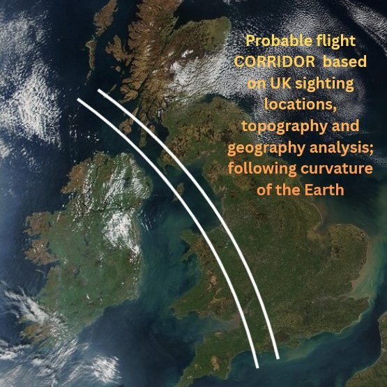
Satelitte Image of the United Kingdon - Daytime
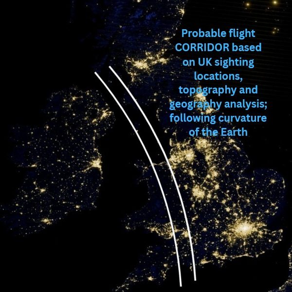
Satelitte Image of the United Kingdon - Nighttime
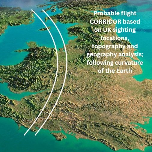
Topography / Geography Image of the United Kingdon